
#1023, Nolte Pond (S)
Installation date: 1985-JUN-07
Coordinates: 39:44:40 N 105:08:16 W
Elevation: 5546'
Record high water: 50.4' (860 cfs), 2004-JUN-08
Lena Gulch Flood Warning Plan, HFP #4
SITE OVERVIEW:
1023 is located in Nolte Pond along Lena Gulch downstream of Youngfield. The homeowner controls the operation of the pond. If he anticipates a rainfall event he will open the 18" outlet to drain the pond and remove the flashboard. Scroll down to see site photos and maps.
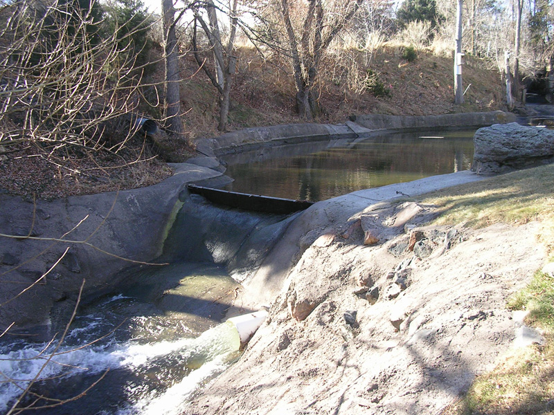
Looking southwest at Nolte Pond spillway
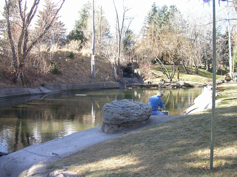
Looking upstream at Nolte Pond
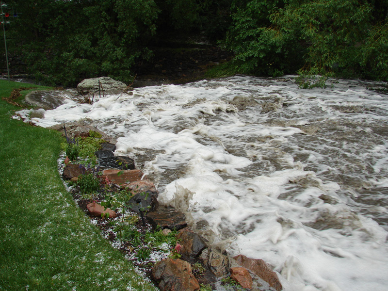
29MAY2007, looking downstream at spillway
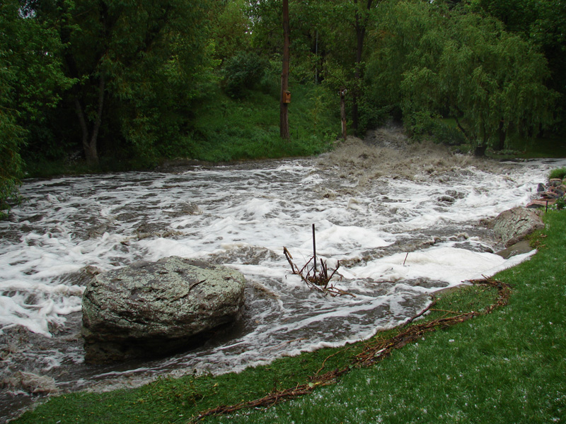
29MAY2007, looking upstream at inflow
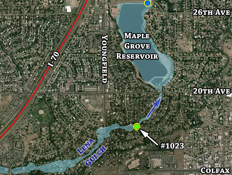
Detailed aerial overview with 100-year floodplain estimate
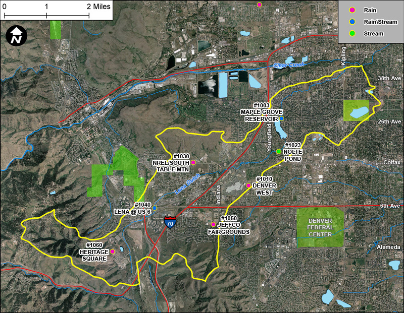
Lena Gulch basin gages