Station IDs

Adobe Acrobat Reader Required List Station Coordinates

COLOR CODES:  Weather Station    Rain & Stream Gage   Stream Gage   Rain Gage

Boulder Creek Flood Detection Network

Boulder Creek/South Boulder Creek Flood Detection Network

Other index maps:  Saint Vrain Creek   Boulder County Rainfall

District Central Flood Detection Network

District-Central Flood Detection Network

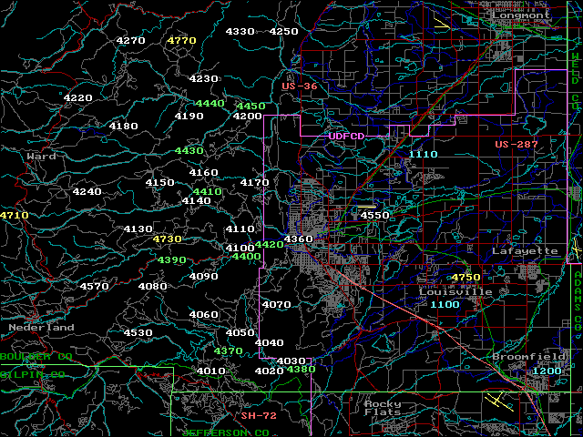
Note: Station No. 2190 "Squaw Mountain" shown on the above map is located further west in Clear Creek County south of Idaho Springs.

Other index maps:  NW Metro   SE Metro   Bear Creek    Lena Gulch   Ralston Creek
                                   Goldsmith Gulch/Harvard Gulch   Toll Gate Creek    Westerly Creek

Douglas County Flood Detection Network

Douglas County Flood Detection Network

Home ] [ Station IDs ] Instructions ] Flood History ] Fire Weather ] Timely Advice ] SVG Displays ] Real-Time Rainfall ] Real-Time Streamflow ] Past Events ] ALERT Mesonet ]