III. DECISION AIDS
General
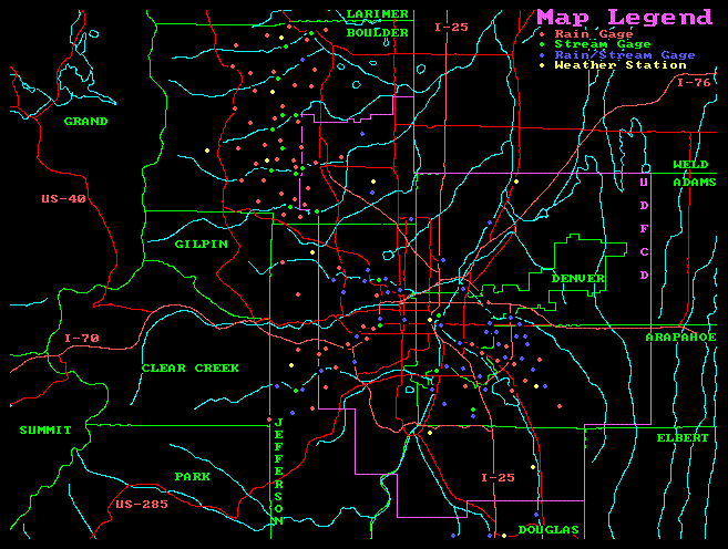
Decision aids are used by the Urban Drainage and Flood Control District's (UDFCD) contract meteorologist, Henz Meteorological Services (HMS), for issuing appropriate messages in accordance with the procedures described in Section VIII. Generalized flash flood guidance, site-specific decision aids and other tools are provided in this section to help technical personnel anticipate flood problems, advise emergency response organizations and guide field resources. These decision aids will be continually updated as experience is gained and more flood data becomes available.
The Ralston Creek drainage basin is equipped with 13 automated gages for early flood detection. This ALERT (Automated Local Evaluation in Real-Time) system measures rainfall at 12 sites and reports current stream and reservoir levels from 8 stations. The system also includes one weather station located near Blue Mountain. ALERT data is transmitted using VHF radios and collected by three base stations located at HMS, UDFCD and the National Weather Service (NWS). The data is used for updating flood forecasts, estimating flood peaks and arrival times, activating base station alarms, and advising response agencies concerning current weather and flood conditions.
HMS is responsible for monitoring the primary base station, evaluating the real-time data and updating forecasts. Simplified charts, tables, computer graphics and hydrologic models are the principle tools used to forecast flood conditions for specific problem areas. The meteorological support for this warning plan is described in Sections VI, VII and VIII.
Arvada and Jefferson County personnel can monitor ALERT gaging station data by dial-up access to the UDFCD base station. Technical staff should make their own assessments of the flood threat by using the gage data, the HMS and NWS forecasts, and any observations obtained from field personnel (police, fire, public
works, etc.) or other reliable sources. Close coordination with public safety agencies should be maintained throughout this process.
The following decision aids are contained in this section of the warning plan:
- Figure III-1 RALSTON CREEK FLOOD PLAIN INFORMATION MAP: This map shows the approximate boundary of the 100-year floodplain for Ralston Creek from Indiana Street (Colorado Highway 72) to its confluence with Clear Creek at Sheridan Boulevard (Colorado Highway 95).
- Figure III-2 RALSTON CREEK/LEYDEN CREEK FLOOD PLAIN INFORMATION MAP: This map shows the floodplain boundary for Ralston Creek from Colorado Highway 93 to Indiana Street, and for Leyden Creek from the Town of Leyden west of Leyden Reservoir to its confluence with Ralston Creek east of Simms Street.
- Figure III-3 VAN BIBBER CREEK FLOOD PLAIN INFORMATION MAP: This map shows the floodplain for Van Bibber Creek from west of Colorado Highway 93 to its confluence with Ralston Creek at the North Jefferson County Ice Arena near West 58th Avenue and Garrison Street. Also shown is the Van Bibber Creek South Tributary floodplain which is located adjacent to the north slope of North Table Mountain.
- Figure III-4 RALSTON CREEK DRAINAGE BASIN & FLOOD DETECTION NETWORK: This map shows the drainage basin and sub-basin boundaries for Ralston Creek its major tributaries; Leyden Creek and Van Bibber Creek. The drawing also shows the ALERT gaging station locations and their corresponding sensor numbers. It is important to understand the location of these gages in relation to the basin boundaries and the flood hazard areas.
- Figure III-5 RALSTON CREEK FLOOD DETECTION NETWORK: This computer generated map also shows the location of the ALERT gages followed by a more detailed tabular summary of sensor numbers, station names, sensor types and general location information. A [+] symbol is used to indicate that the station measures more than just rainfall or stream water levels.
- Table III-1 URBAN FLASH FLOOD GUIDANCE: This table provides very basic rule-of-thumb guidance to help anticipate flood problems along small urban streams using either forecast or measured rainfall amounts. The table is most applicable to streams draining less than ten square miles but may be applied to larger streams given proper consideration to predicted storm size, aerial coverage and basin rainfall averaging. The indicated flood potentials and recommended actions are considered typical for urban streams in this region. Knowledge of local problem areas and existing flood control improvements will allow decision-makers to specify required actions.
- Table III-2 TWO HOUR CONVECTIVE STORM CHARACTERISTICS: This table is used to estimate the frequency of either forecast or measured point rainfall. Both the total rainfall and intensity columns need to be considered when making an estimate. Knowledge of hydrologic principles and basin runoff characteristics is required for proper use this table. When predicting flood magnitudes for specific locations, the forecaster must apply basin rainfall averaging techniques or use an alternate method. The approximate storm size and the spatial distribution of rain can be estimated using ALERT gage data, weather radar, or a detailed quantitative precipitation forecast (QPF) from HMS. Hydrologic forecast point (HFP) guidance can then be used to anticipate site-specific flood problems.
- Figure III-6 MOUNTAIN STREAM FLASH FLOOD GUIDANCE: This graph provides very basic rule-of-thumb guidance to help predict the magnitude of mountain stream/canyon flooding from either forecast or observed rainfall. The watershed's antecedent moisture condition and the maximum one-hour, ten square mile rainfall average must be estimated to properly use this graph.
- Figure III-7 HYDROLOGIC FORECAST POINT (HFP) GUIDANCE: The first page of this figure contains a location map showing selected HFPs along Ralston, Leyden and Van Bibber Creeks. Site-specific flash flood guidance for each HFP is provided on subsequent pages. Certain HFPs are co-located with ALERT stream gages. HFP decision aids can be used with either forecast or measured rainfall to anticipate flooding for known problem areas (e.g. developed floodplains, road crossings, irrigation ditch spill points, depressions, low-lying areas, reservoirs). The general procedure for estimating flood frequency is described above (see Item No. 7, Table III-2).
- Figure III-8 STAGE SENSOR COMPUTER GRAPHICS: Real-time displays of current stream and reservoir water levels, and basin rainfall have been developed for ALERT base station operations. These displays update automatically as data is received. Each graphics templet provides information regarding critical flood stages; local problem areas; historic floods; flood frequencies; alarm and sensor levels, and structure dimensions and elevations.
The Decision Making Process
The earliest indication of flood potential will likely be a precipitation forecast from HMS. When significant rainfall is expected, HMS will provide a detailed QPF with probability estimates for various predicted rainfall amounts and storm types. The QPF product will also identify the most likely problem areas. If the Ralston Creek basin is included, Table III-1 should be used to estimate the flood potential and decision-makers should consider the recommended actions. Table III-2 and the HFP decision aids (Figure III-7) should then be checked to determine if the forecast rainfall will cause problems at or near the HFPs. If no problems are anticipated based on this review, a normal level of vigilance should be maintained. However, if the decision aids indicate a dangerous flood potential, a higher level of awareness should be maintained and appropriate preparedness actions taken.
Once rainfall has begun and the gages are reporting rainfall amounts, the flood threat can be further analyzed. By determining the maximum 10-, 30- and 60-minute rainfall amounts which either have occurred or are projected, flood predictions can be updated. Periodic projections should be made until the rainfall event has passed and problems have either occurred or the threat no longer exists.
The final confirmation that the drainage basin is indeed responding to significant rainfall is the rising stage measured by the ALERT stream gages, and field reports from police, fire, public works personnel or other reliable sources. Although it is tempting to wait for this final confirmation, doing so will severely limit the time available to warn floodplain occupants and dispatch emergency personnel to critical areas.
Once the decision has been made that a significant flood hazard exists, it is imperative that the warning and response elements of this plan be implemented.
ALERT SYSTEM SUMMARY
Ralston Creek Flood Detection Network
Local Govt. County Nearest Stream ID Station Name (Location) Sensor Type
Arvada JEFFERSON Ralston Creek 100 Carr Street (Brooks Drive & Carr St. - SW) RAIN
103 WATER LEVEL
Arvada JEFFERSON Ralston Creek 110 Ralston Reservoir (64th & S.H. 93 - NW) RAIN
113 WATER LEVEL
Arvada JEFFERSON Ralston Creek 120 Croke Pump Station (Canal xing E. of Quaker) RAIN
123 WATER LEVEL
Arvada JEFFERSON Ralston Creek 133 Simms Street (@ Ralston Creek crossing) RAIN
Jefferson Co. JEFFERSON Coal Creek 137 Blue Mountain (Howard Lacy property, Sec. 14) WIND SPEED/DIR
140 RAIN
141 REL. HUMIDITY
142 TEMPERATURE
Jefferson Co. JEFFERSON Nott Creek 150 Nott Creek (Golden Gate State Park, Sec. 19) RAIN
Arvada JEFFERSON Leyden Creek 200 Leyden Reservoir (82nd & Indiana - SW) RAIN
203 WATER LEVEL
Arvada JEFFERSON Leyden Creek 210 Leyden Confluence (East of Simms St.) RAIN
Table III-1
URBAN DRAINAGE AND FLOOD CONTROL DISTRICT
URBAN FLASH FLOOD GUIDANCE
DENVER, COLORADO
FORECAST RAINFALL FLOOD POTENTIAL RECOMMENDED ACTIONS
----------------------- ----------------------- ----------------------
Total Amt.= 0.5" to 1" Streets,low-lying areas Prepare for routine
intersections. nuisance flooding.
Total Amt. = 1" to 2" All of above plus small Prepare for flooding
streams bankfull. of freq. problem areas.
Total Amt. = 2" to 3" All of above plus flood Prepare for street
plain inundation. closures.
Total Amt. > 3" Major overbank flooding Prepare for floodplain
expected. evacuations.
NOTE: Rainfall amts. & NOTE: Refer to
basin NOTE: Use judgement on
guidance information flood warning plans for when to warn public.
apply to short duration site specific data. Maintain contact with
storms (<= 1-hr). meteorologist.
Table III-2
URBAN DRAINAGE AND FLOOD CONTROL DISTRICT
2-HOUR CONVECTIVE STORM CHARACTERISTICS
Denver, Colorado: Precipitation Frequency/Depth/Intensity Data
(INCHES)
| Total | | 10-min max | 30-min max | 60-min max |
| Freq. | Rain | Low-Avg-High | Low-Avg-High | Low-Avg-High |
------- | ----- | ------------ | ------------ | ------------ |
| 2-yr | 1.2 | 0.3-0.4-0.5 | 0.6-0.8-1.1 | 0.8-1.0-1.2 |
| 5-yr | 1.6 | 0.4-0.5-0.7 | 0.8-1.0-1.4 | 1.1-1.4-1.6 |
| 10-yr | 1.9 | 0.5-0.6-0.8 | 1.0-1.2-1.7 | 1.3-1.6-1.8 |
| 25-yr | 2.2 | 0.6-0.7-0.9 | 1.1-1.4-1.9 | 1.5-1.9-2.1 |
| 50-yr | 2.6 | 0.7-0.8-1.1 | 1.3-1.6-2.3 | 1.8-2.2-2.5 |
|100-yr | 3.0 | 0.8-1.0-1.3 | 1.5-1.9-2.6 | 2.0-2.6-2.9 |
NOTES:
- Use the "Avg" columns for estimating rainfall frequency.
- For "rainfall frequency" to equal "flood frequency," the areal coverage of rainfall must be over the entire basin. Therefore, estimate basin average rainfall when making flood forecasts for specific locations.
- Table III-1 only applies to streams in the URBAN portion of the drainage basin. Use Figure III-6 when forecasting flood magnitudes for mountain streams. HFP guidance should be used where appropriate (see Figure III-7).
- Above tables are not recommended for making main stem predictions on streams draining more than 10 square miles or for reaches immediately below dams.
HFP LOCATION DESCRIPTIONS
- HFP #1 Ralston Reservoir west of Colorado Highway 93 (ALERT Sensor 113).
- HFP #2 Arvada Reservoir on Ralston Creek east of Colorado Highway 93.
- HFP #3 Ralston Creek crossing of the Croke Canal east of Westwoods Golf Course (ALERT Sensor 123, Croke Pump Station).
- HFP #4 Ralston Creek at Simms Street (ALERT Sensor 133).
- HFP #5 Ralston Creek upstream of Carr Street (ALERT Sensor 103).
- HFP #6 Leyden Creek at Colorado Highway 93.
- HFP #7 Leyden Reservoir (ALERT Sensor 203).
- HFP #8 Leyden Creek at confluence with Ralston Creek east of Simms Street (ALERT Sensor 213).
- HFP #9 Van Bibber Creek at Colorado Highway 93 north of Golden (ALERT Sensor 333).
- HFP #10 Van Bibber Creek at Indiana Street downstream of the Croke Canal crossing.
- HFP #11 Van Bibber Creek at West 58th Avenue west of baseball fields (ALERT Sensor 323, Sports Complex).